|
|
|
Thursday April 26, 2001
3:30 pm
(10:30 am CDT)
All Photos © Tim N. Touchton
This web site is designed to be viewed if you maximize your
window.
The pages may take a few moments to load the first time.
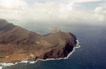
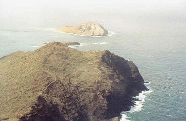
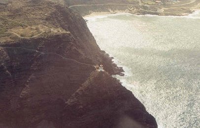
Here's a shot of the Makapu'u Point Coastline. You can see
Rabbit Island as well as barely see the
Makapu'u Lighthouse sitting on the edge of the cliff to the right. You can see
the "road" trail heading
to the lighthouse in the photograph to the right, and in the photograph below.
Please check out my Makapu'u Lighthouse page also. The white fenced "trail"
from the
road to the lighthouse is closed off due to rock slides so we were not allowed
to
get close to the lighthouse, as others have been able to in the past. We had
to view
the lighthouse from the ledges above. There is an observation area directly
above
the lighthouse and it is often used for whale watching.
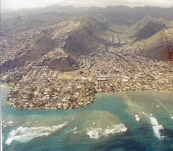
I'm not sure where I took this photo, but it shows
how the subdivisions and businesses build around
the landscape.
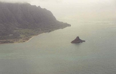
This is a photograph of Chinaman's Hat. You can actually
walk
out to it during low tide and I've read that it's a really cool island
to explore. We did not visit this island, or this area of O'ahu.
COPYRIGHT INFORMATION
- All of the photographic images in this web
site as well as all of the written content in this web site are protected
by copyright and are not offered for commercial, public or personal use without
prior written consent. Please do not copy and/or distribute the images or the
written
content contained in this web site in print or digital form. Distributing images
or the written content from this web site may put you or others at risk for
copyright violations.